Using VR to Virtually Scout a Drone Shoot
One of my university projects includes aerial footage to be used in a VFX shot. I had a few ideas for possible VFX techniques but need some test footage to prove my idea works before travelling further afield to a remote shoot location.

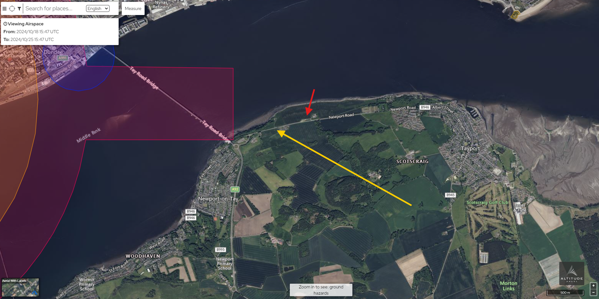
As I reside in Dundee it is important to find an area with similar terrain to the intended shot but still easily accessible. The most suitable shooting location I was able to find was just over the bridge in Tayport. The area has a clear landscape that is mostly used as farm land. Due to the FRZ surrounding Dundee Airport most of Dundee is out of the question for drone shooting making Tayport a suitable spot. As you can see in the above image, the proposed take off point (red) is out of the FRZ and the flight path for the shoot (yellow) also clear of the FRZ. It is also important to consider the legislation surrounding drones. As my drone weighs more than 250g it can't be flown within 50m of people making the chosen shooting location safe to take off from.
Now that a suitable location had been identified, I could begin scouting the shoot location using Google Earth VR. I like using Google Earth VR as it helps visualise the terrain topology and I could begin to put shots together.
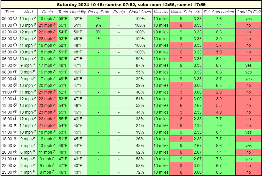
Now that shots have been established and the area deemed safe to shoot in, the time came to schedule a flight. Due to bad weather forcast soon the shoot needs to take place ASAP. Reviewing the weather forecast and checking GPS sattelite positioning Saturday 19th seems like the most suitable day to shoot. As you can see below the forecast I am working from.

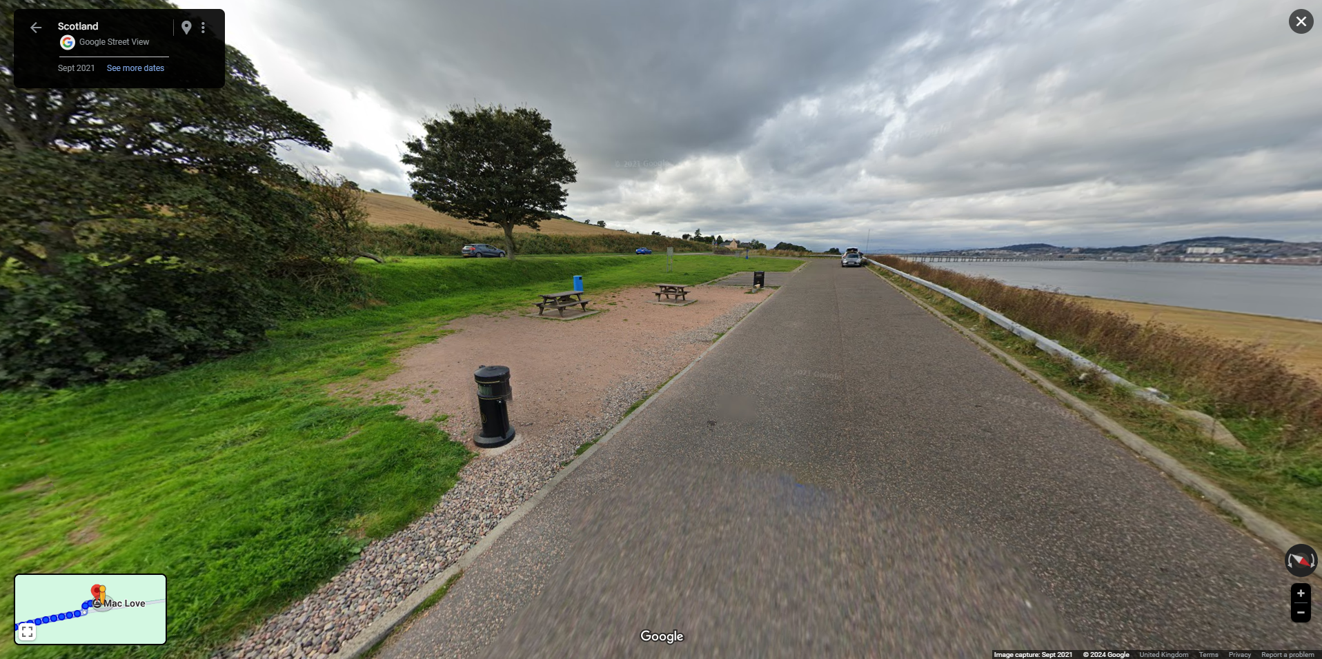
I then checked Google Street View to ensure the take off point is suitable.

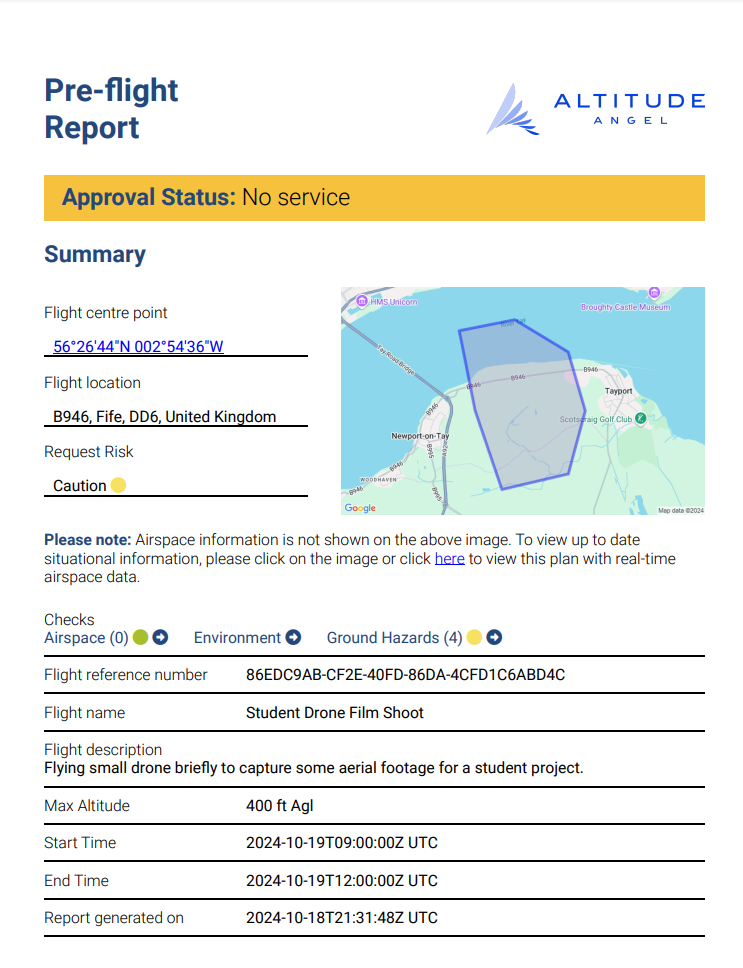
Now that a flight plan has been established I could log it with Altitude Angel ensuring other aircraft and drone pilots are aware that filming is taking place and minimise any risk.
